Nodes: Metadata
Colour tiles by class or by number, class opacity
Tiles often carry data besides their geometry: a building's type and height, a LiDAR point's class and intensity. The Nodes: Metadata panel reads it and colours the tiles with it.
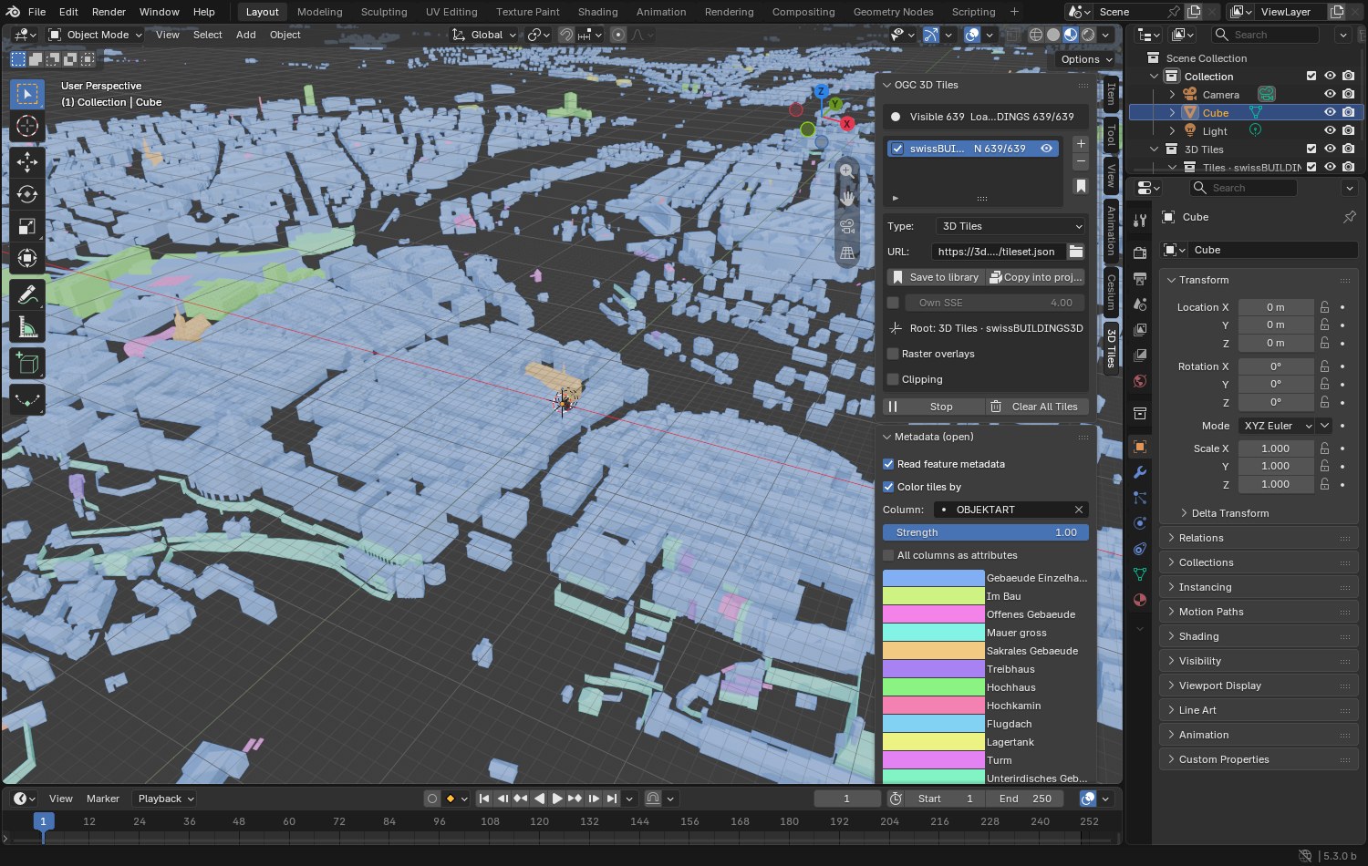
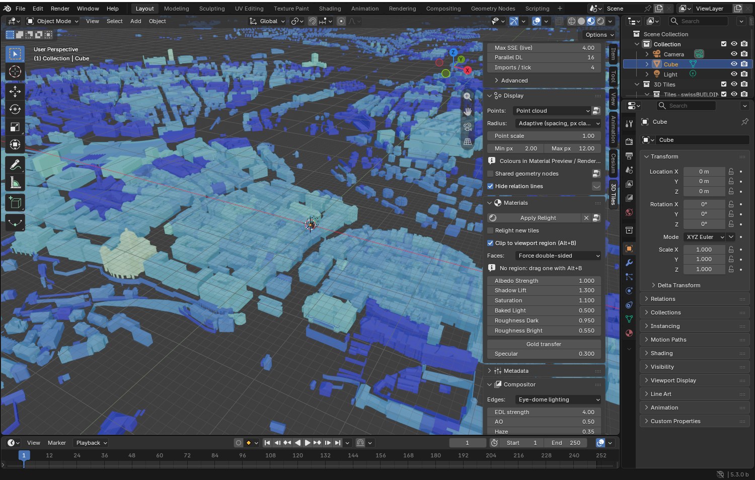
Use it
- Tick Read feature metadata before pressing Start. It needs the cesium-native backend.
- Once tiles are in, tick Color tiles by and pick a Column.
- Text and class columns get a legend, numbers get a colour ramp.
| Setting | What it does |
|---|---|
| Strength | How much of the metadata colour replaces the tile's own. Lower it to see a raster overlay through the colours. |
| Legend (classes) | One colour and one opacity per class. Opacity 0 hides the class: the ground of a LiDAR cloud, for one. |
| Color Ramp (numbers) | Add, move and recolour its stops. Edits are kept. |
| Custom range (numbers) | Sets both ends of the ramp by hand, live. |
| All columns as attributes | Keeps every column on the tiles, not only the active one, for your own shaders and Geometry Nodes. About 40 MB per column on 10 million vertices. |
Point clouds
Point values work the same way, per point.
- Intensity and other numbers go through the ramp. The ramp spans the 1st to 99th percentile, since LiDAR intensity has rare huge values.
- Classification is a class column with the LAS 1.4 names and the colours LiDAR viewers use (2 Ground, 5 High vegetation, 6 Building...). Classes 64 and above are user-defined and keep their number.
Tested on an IGN LiDAR HD COPC tile streamed by 3dtiled, which sends both when the tileset URL ends
with &attributes=intensity,classification.
Colour by level of detail
Two columns come from the tileset's hierarchy instead of its content, one value per tile, through the Color Ramp:
- tile level: how deep the tile is in the hierarchy, 0 being the root. Tilesets that nest other tilesets count those levels too.
- tile error (log2 m): the geometric error the tile declares, as a base-2 logarithm, since it roughly halves at each level. 3 means 8 m, 0 means 1 m, -10 stands for tiles that declare none.
They show which level of detail is on screen where, and where two levels meet.
A third one, tile (random color), gives every tile one of 24 palette colours, to see the tiles themselves. A tile keeps its colour when it comes back.
For your own nodes
- Each tile has an
ogc3d_featurevertex attribute (the row of the table) and ameta_<column>attribute for the active column. - The full table stays on the tile object, as JSON in the
ogc3d_featurescustom property. - Metadata of the tileset shows in the panel; that of groups, tiles and contents is in the
ogc3d_tile_metadatacustom property of each tile.
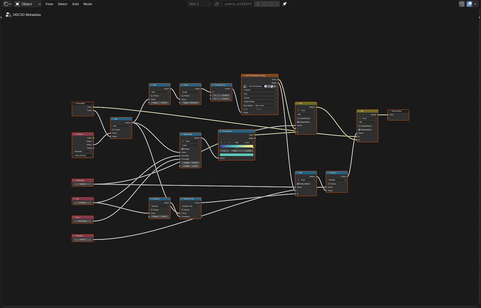
The node group
Color tiles by is the OGC3D Metadata group, placed before the shared shader nodes in each tile's
material: a palette lookup for classes, a Color Ramp for numbers, and the mix with the tile's own
colour.
What is read
EXT_structural_metadatatables, and b3dm batch tables, which cesium-native converts.- Per-point attributes:
EXT_structural_metadataproperty attributes,pntsbatch tables, and plain scalar attributes such as_INTENSITYand_CLASSIFICATION. - Metadata in textures: feature id textures and property textures, 8-bit channels only. The column in use becomes one image per tile.
- Text columns become classes shared by all tiles. Columns that differ on every row, like UUIDs, stay in the table only.
- Not read yet: vector columns, and tile metadata stored in implicit subtrees.
Measured on swissBUILDINGS3D over Bern, 608 tiles: about 10 ms per tile on the worker threads, 2.7 MB of JSON for 468 tiles on screen, and 0.5 s to switch to another column.